Alerts that may save Lives
An estimated 5,000 fishermen drown during storms on just Lake Victoria every year. StormWatch predicts and send alerts in cases of expected hazardous storms.
Subscribe
or
StormWatch
to
+255 67 704 5957
StormWatch in a Nutshell
StormWatch uses a combination of state-of-the-art satellite remote sensing, a high-resolution regional climate model and coarser-scale ensemble simulations to project changes in extreme precipitation over Lake Victoria and send out public alerts.
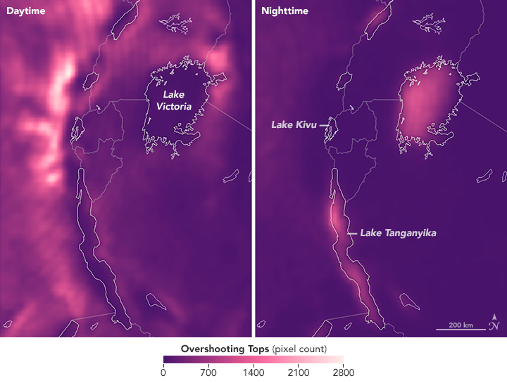
Photo NASA EARTH OBSERVATORY
The maps above show a representation of the storm pattern as observed by weather satellites. Bright colors show areas where the scientists counted pixels filled with overshooting cloud tops associated with thunderstorms. The figure on the left shows the location of overshooting tops by day, while the right image shows how they concentrate over lakes at night.